©2019-2020 tenmintokyo.com
By Staff
Page may take a while to load due to photos.
Name: Itabashi
Kind: Town
Location: 35°44’45.85″ N 139°43’03.77″ E
Our Rating: ⭑⭑⭑⭑
Worth it? Yep.
In Part 1, I discussed my return to the small Japanese town of Itabashi after 18 years. For links + videos, see that post.
In Part 2 I’ll cover the town itself – things to do and see, and how to get around.
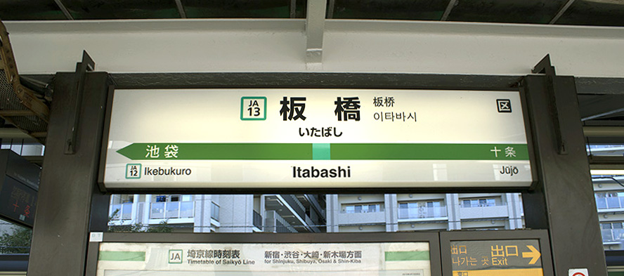
Train Stations
There are 4 major train stations in Itabashi – and several exits: JR Itabashi Station, Shin-itabashi Station, Shimo-Itabashi Station, and Naka-Itabashi Station.
JR Itabashi Station is covered in Part 1. Shin-Itabashi Station is just a few blocks northwest of JR Itabashi Station. We’ll discuss it below.
First the JR Line. The main Itabashi station is on the JR Saikyo Line, and is between Jujo to the north, and Ikebukuro to the south. This is very advantageous – Ikebukuro is one of the biggest and most important interchange hubs on the JR lines, and can be used to route you to other parts of the city quickly – such as Eastern Tokyo (via Chuo Line), and south to Shinjuku. You can also get the Maronuchi Metro Line at Ikebukuro, which shoots you right into the heart of the Maronuchi district, or south to Shibuya. Itabashi is just far enough away to be inexpensive to stay at, but close enough to get to the major interchange stations in just a few minutes. In addition there is a lot to do in Ikebukuro itself, and if you stay in Itabashi you can sight-see in Ikebukuro without paying more for a hotel.
One stop to the north past Jujo Station is the small town of Akabane – also well worth a look. Jujo has a small shopping arcade. You can hit both Jujo + Akabane in 1 day and see it all.
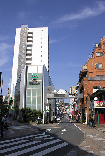
Shin-Itabashi Station is on the Toei Subway Line, and is just a few blocks from the main JR Itabashi Station. To get here, exit the main Itabashi Square area and head to the west side of JR Itabashi Station. There are several ways to do this – 1) Go through JR Itabashi Station, climb the stairs at the far end, exit at the top, head west, and into the square, 2) go through the small pedestrian tunnel at the south exit of the station, turn right on the first side street, and north into the square, or 3) walk north from the main Itabashi Square, then head west, then southwest down side streets to get to the square. The west/north side square is located at 35°44’47.04″ N 139°43’10.81″ E the main square is located at 35°44’43.10″ N 139°43’12.82″ E. The main station sits between them.
Once in the west square, head north out of it, turn left at the first street, then right at the next major intersection, then left 2 blocks past that, then 2 blocks up a curved road. It’s just a few blocks. Shin-Itabashi Station is on the left at the corner of the Nakasendo Hwy. Interestingly, if you head south on this highway, towards the town of Sugamo to the south, on the left and right sides, you’ll find entrances to the Toei Nishi-Sugamo Station around 35°44’37.88″ N 139°43’42.67″ E (the I-16 stop on the Toei Mita Line).
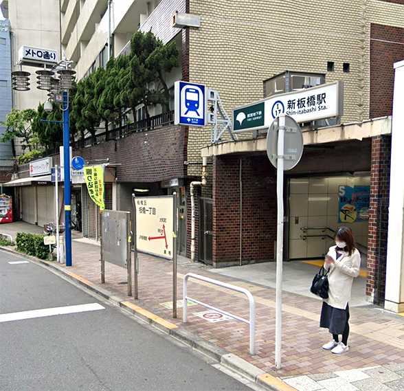
Shin-Itabashi Station.
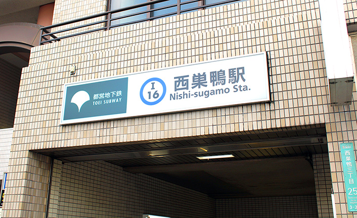
Nishi-Sugamo Station on the Toei Mita Line to the southeast. Sugamo is one town south of Itabashi on the Nakasendo Hwy. In fact you can walk there from Itabashi in just a few miles.
Shimo-Itabashi Station
Shimo-Itabashi Station is in the opposite direction – west of the APA Hotel, and on the Tobu Tojo Line. To get there, get to the west square outside the main JR Itabashi Station, head down the street to the south, turn right at the next street, follow it up to the YorkMart supermarket, then turn left. It’s one block to the left and you can’t miss it. Shimo-Itabashi Station is at 35°44’43.91″ N 139°42’53.47″ E.
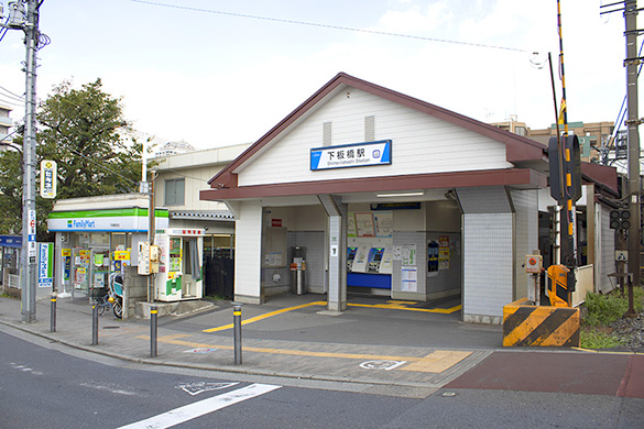
Shimo-Itabashi Station on the Toei Mita Line to the west. To get here, head south, then west from the west main square, up the street, then left at the YorkMart supermarket:
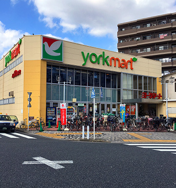
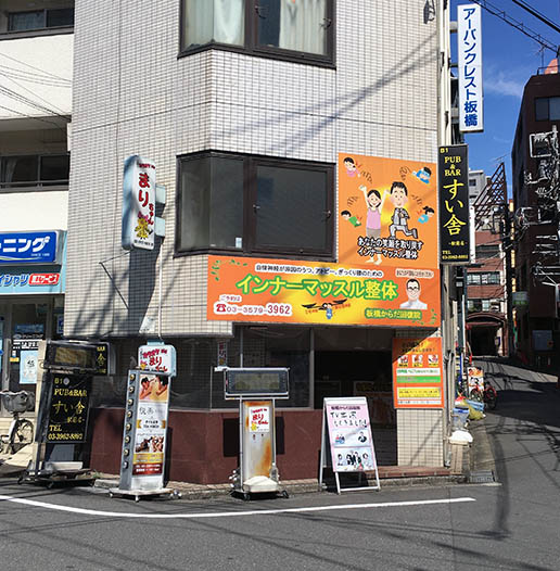
To get to the YorkMart, and station, head left (west) past this bldg. just west of the west square, which is to the right in this photo.
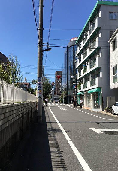
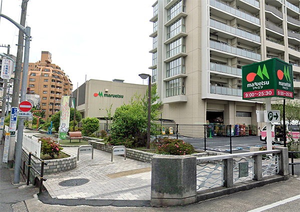
To get to the YorkMart, and station, head left (west) up this white-picketed street. The station is just up on the left 1 block. In early fall in Tokyo, the weather is usually still quite nice and summer-like. Just to the left of this is a large Maruetsu grocery store as well.
We won’t cover the Naka-Itabashi Station because it’s several miles to the west, but it’s interesting nonetheless. It’s also on the Tobu Tojo Line. There is also a nice shopping street + cafés around the station. There’s also a vast long walkway along a small tributary river which you can walk all the way back into central Itabashi. In fact, this waterway runs all the way back east to the Arakawa River, which empties to the south into Tokyo Bay.
South to Ikebukuro
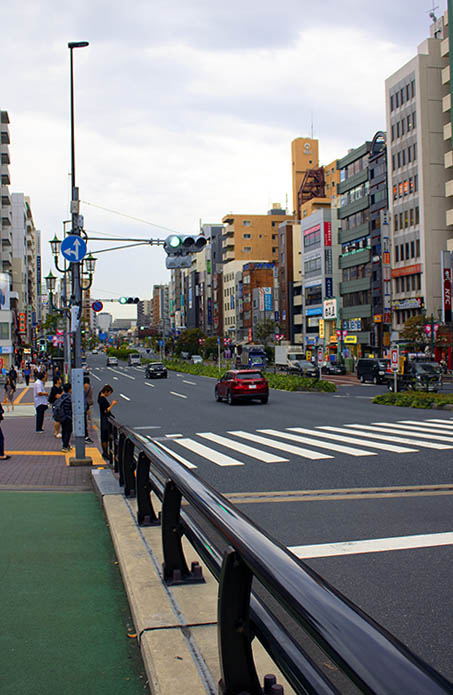
Before we get to Itabashi’s main attractions, as a footnote, note that Ikebukuro is just to the south. Itabashi is so close to Ikebukuro, you can walk there. It’s less than 1.5 miles. Or of course, you can take the JR Saikyo Line 1 stop south. To walk, get to the east square outside JR Itabashi Station, head south past the koban, past the APA Hotel, and follow the street all the way east to Rt. 305. Once on 305, head south (right), and walk to Ikebukuro. Very short and easy walk.
Local Attractions
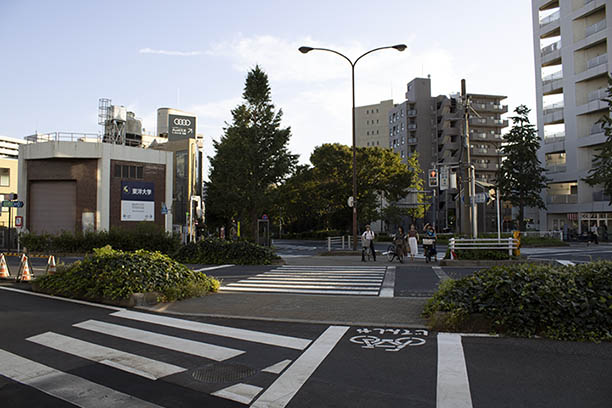
Itabashi is small Japanese town, and there aren’t any big, spectacular attractions. That doesn’t mean there’s nothing to do, and nothing to see. In fact, the town is quite charming with shopping streets, and a main walk all the way to Sugamo to the south along the Nakasendo Hwy, as mentioned above. There are 6 main areas: 1) the area to the east of the station where the main square is, with shops and cafés, 2) the area on the west side of the station, also with side streets + shops/restaurants/cafés. 3) the large shopping street to the north of the Nakasendo Hwy – well worth a look. Lots of charming cafés along this walk. There is also a huge Life Supermarket along this street, 4) the Nakasendo Hwy itself – which you can walk all the way to the south to Sugamo, and beyond that, Tokyo Dome City, 5) Happy Road Oyama Shopping Street, 6) Sugamo Jizodori Shopping Street.
Let’s take these 1-by-1:
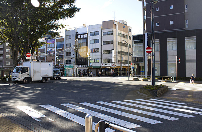
East Square + Shops
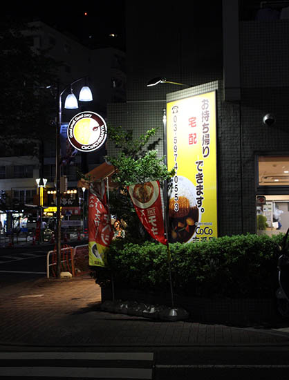
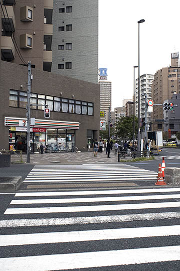
Outside the JR Station east exit is a small park with new benches, a fountain, and lots of shops and cafés around the area. On the street to the south are several cafes, and there are restaurants to the north including a big Italian place. There is also a nice Lawson conbini at the square where you can get some food to take back to the hotel/square, although eating in public is frowned on by the Japanese in general. There’s a also a new small public toilet in the square.
If you head right outside the east square, there are lots of side streets + things to explore. 2 blocks to the north is an east-west street which leads to the west square on the other side of the station. To the right is a small 7-11 and supermarket, along with a lot of other shops. To the south, a nice large Family Mart conbini. If you go farther east to the next main north-south street and turn right, you can get to Ikebukuro in less than 2 miles.
Looking north just outside the east square. Lots of restaurants and shops. If you head left at the 2nd light above, you’ll come to the west square. There is also a 7-11 and small supermarket just a few blocks to the right. The Lawson is just to the left before the 1st light.
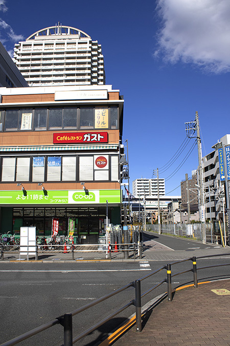
East-west road from west square outside Itabashi Station. Turn right here, then right again to get to the south/east side of the station. The CO-OP grocery on the corner is quite good and inexpensive. Just above that is a Gusto Café.
More nice local restaurants and shops on the east side.
Explore the area to the east of the station – side streets and interesting things around every corner. If you go far enough east, you’ll come to Rt. 305, which leads to Ikebukuro to the south.
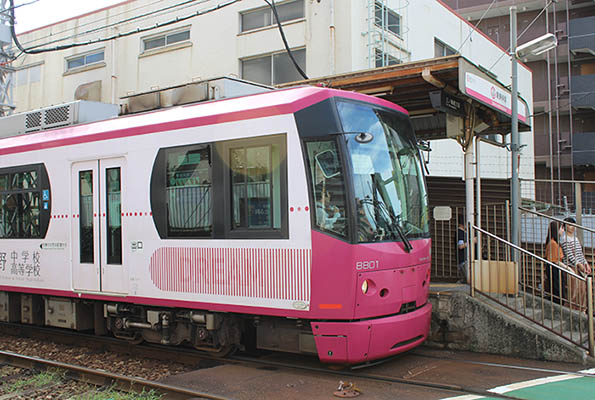
Also on the east side – further east beyond the shops – is the Toden Arakawa Line – better known to locals as the Sakura Tram – and is one of the last small-scale functioning trams in Japan. You can buy a ticket at the station, and ride a loop line around Tokyo and back. The tram has huge windows – giving a vast and clear view of the surrounding area.
West Square and Streets
To the west of the station is another central square, with side streets with lots of shops, restaurants, cafés. If you walk far enough west down the side streets from here, you’ll find the YorkMart grocery store. There is another large grocery (CO-OP) on the corner on the north side of the block the square is in too. To get here, exit JR Itabashi Station at the west exist, and head straight ahead.
A pano of the west square – west exit from the JR Itabashi Station on the left, square in the center, around to the bike locker on the right. Turning right beyond the bike locker takes you down a road to the east side of the station. The large organic grocery (CO-OP) is the orange building shown on the right to the north of the bike locker. The bike locker here is paid, but fairly cheap – around 400¥ for 16 hours. If you leave a bike here, you’ll need to feed the parking machine once a day.
View from the west side square. Side streets are in the center. There is also a nice café on the corner. A Welcia drug store is also down this street. To get to the YorkMart grocery store, head down the street to the left, turn right at the next intersection, then west up the street.
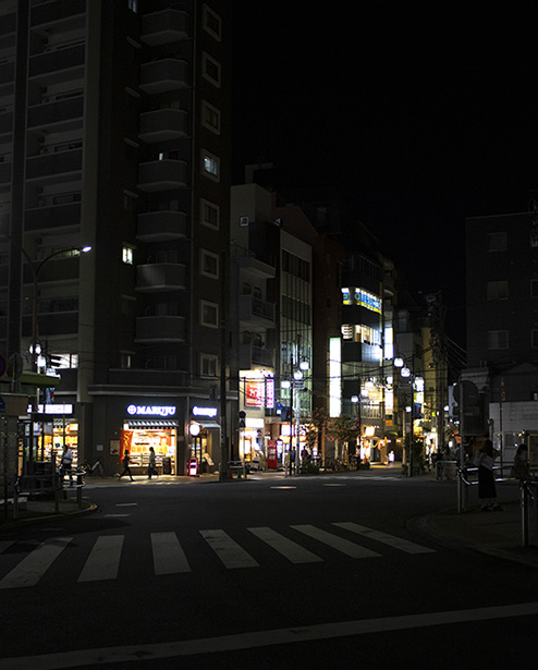
The west square at night. The Maruju Café on the corner is quite good.
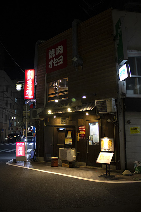
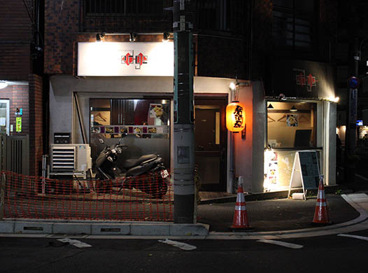
Another restaurant on the backstreets on the west side.
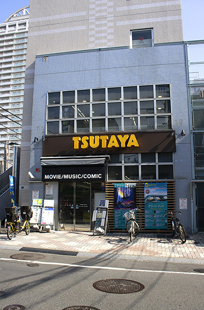
Just to the east of the CO-OP grocery, across the railroad tracks is a large TSUTAYA record shop. If you continue right from here for a block, then right again, you will come to the east square.
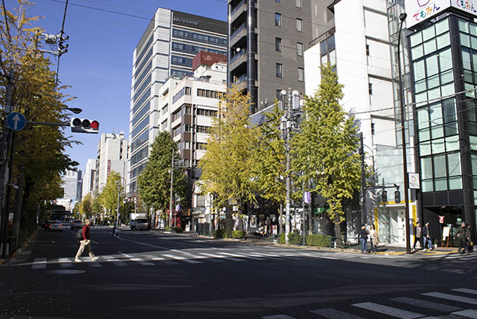
Shopping Street to the Northwest of Nakasendo Hwy
At 35°45’00.43″ N 139°42’48.55” E along the Nakasendo Hwy, a long shopping street splits off to the west. It’s well worth a look and goes on for miles. To enter, look for the 1950’s-style Gusto Café on the right, and the Percona Bank on the left. This is where the entrance is. To get to this entrance from the city square, head north on side streets from the station, cross the Nakasendo Hwy, and get onto the sidewalk on the north side. Head west. Keep walking several blocks, until you find the entrance. There is also a nice Family Mart along this area. This street has all kinds of shops and nice cafés like something you’d find in Europe. There is also a huge Japan Post Office here.
Shopping street entrance. Nakasendo Hwy is just on the left. This is facing northwest.
Nakasendo Hwy facing west. There are also sidewalks for peds and bikes.
Nakasendo Hwy facing southeast towards Sugamo. We’ll get to this next.
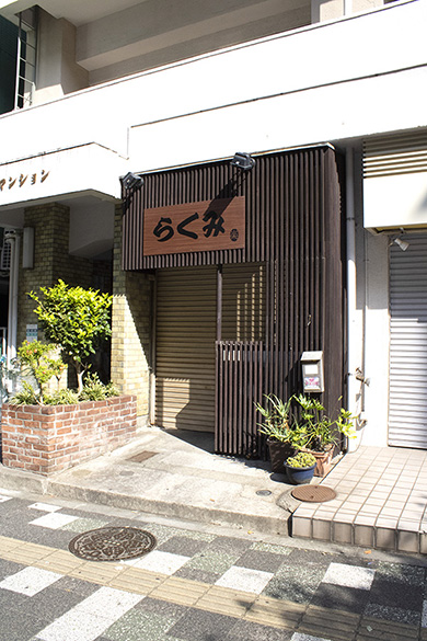
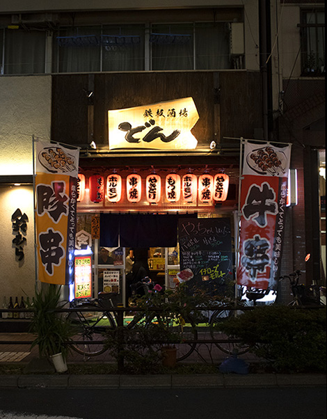
Along Nakasendo Hwy. there are a lot of nice cafes and shops you can check out too.
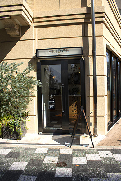
The Bridge Café.
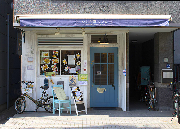
There are plenty of nice cafés along the street you can visit.
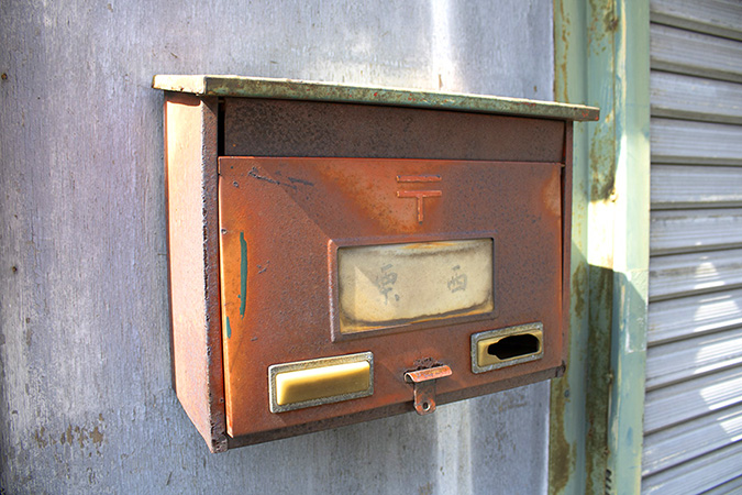
There are all sorts of old interesting things to see along the shopping street. In this case, an old Japan Post residential mailbox.
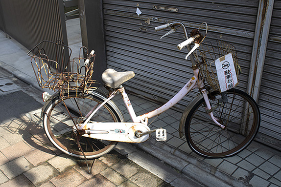
An old abandoned bike along the shopping street – with a warning telling the owner to remove it. This has been sitting here at least 10 years, maybe 20. Probably once a young girl’s bike – now since long moved on. The ghosts of the past.
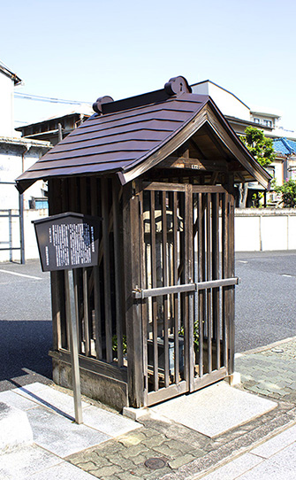
A small historical monument.
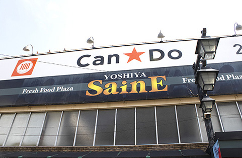
There is also a Can*Do 100¥ shop on the street too.
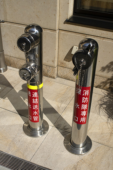
Chrome-plated fire hydrants along the street – the Japanese don’t mess around.
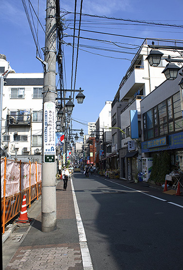
The main shopping street, looking west.
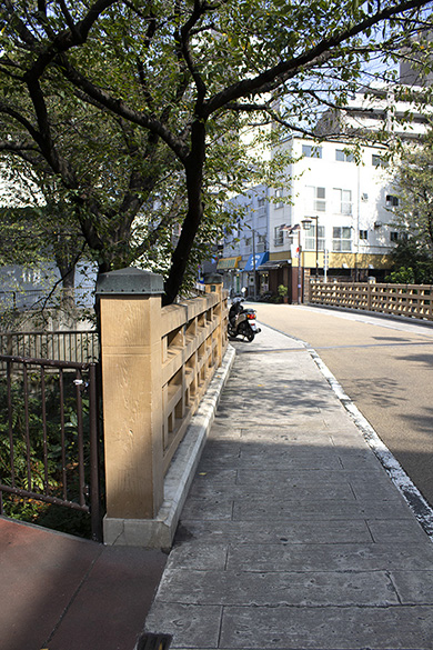
Further up the street you will come to this bridge, which is a good photo spot.
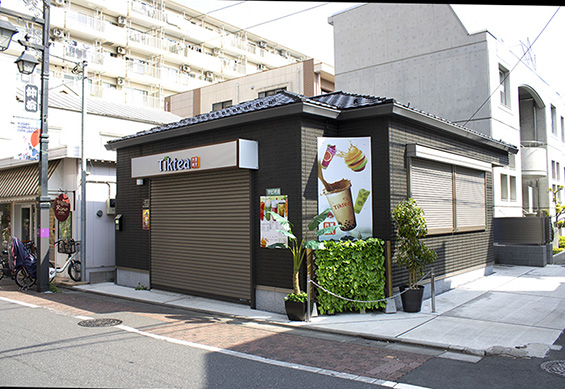
Lots of small food shops such as Tiktea line the street.
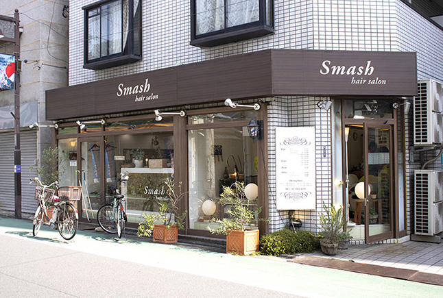
The Smash Hair Salon. Typical Tokyo cool.
Happy Road Oyama Shopping Street
Far to the west of the central part of Itabashi is shopping street called Happy Road Oyama Shotengai. It’s located at 35°44’52.85″ N 139°42’07.87″ E and runs east to west. Definitely worth a stroll.
Nakasendo Hwy SE->Sugamo->Tokyo Dome City
Starting at approx. 35°44’54.94″ N 139°43’17.21″ E – just north of the town center in Itabashi, you can go all the way southeast on the Nakasendo Hwy – stop in Sugamo, then beyond down to Tokyo Dome City (TDC). It’s only a few miles + walkable in a few hours. On bike, about 25 mins. Very easy. A nearly straight shot.
There are a few gotchas – such as the road split about 1/2 way to TDC which you must be aware of – we covered that in another post about biking from Itabashi to TDC. Don’t forget the Japanese drive on the left so it’s a good idea to stay on the left sidewalk side of the road.
The city has installed a new bike lane on part of the road near the universities area north of Tokyo Dome, so that part is easy and safe – but sometimes delivery trucks will park in the new bike lane – so be careful.
From Itabash Station, walk north ’til you hit Nakasendo Hwy – you can’t miss it since it’s a huge 2-lane street. You may want to cross to the north side of the street once on the sidewalk, then head right (south).
Footnote: Nakasendo Hwy later changes names down near TDC – and is called Hakusan-Dori or Rt. 403. The two are synonymous.
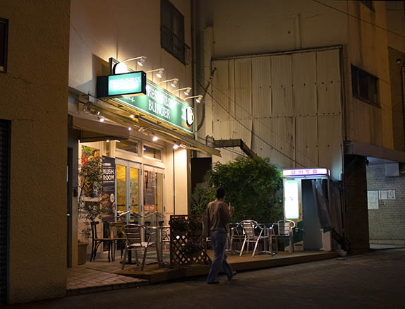
There are 3 main areas on the way: central shops and sidewalk to Sugamo, Sugamo area + station itself (there’s another nice APA Hotel in Sugamo), road split + university area after Sugamo, and Tokyo Dome City/Bunkyo Civic Center at the end. Along the way there are all kinds of restaurants and shops – including a MOS Burger, and Freshness Burger. There is also a very nice chocolatier shop near the Freshness Burger – just south of it on the same side of the street, in fact.
So…. here’s how to go:
First you’ll go south on the Nakasendo Hwy for a long way. There’s not much to mention here – lots of ordinary high-rise apartments, and some shops. This part looks like this:
This part goes on for quite a way – keep going.
After a while you’ll come into an area with more shop/gas stations/food/retail:
Keep going – head past this + just keep heading south.
After a while you’ll come to a similar area with a MOS Burger on the left, then critical split in the road, which you must take. If you don’t, you’ll end up way to the east on Old Hakusan-Dori which will lead you away from TDC. We show both below:
Continue on the left here ’til you hit the MOS Burger:
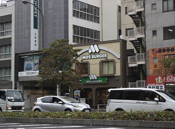
As a footnote – if you turn left on the next street immediately after the MOS Burger, you end up in Komagome – another small Japanese town. At the end of that street is world-famous Rikugien Gardens (See links + vids below).
Now the critical split: just on the right, you’ll see the area shown below with a weird split in the street – there’s a light on the right, with a bike lane about 5 ft. long, then another street, then another sidewalk across the street. This photo is facing southwest:
Wait for the crosswalk signal, then proceed across.
Old Hakusan-Dori goes off to the left. You don’t want that – you want to cross to the other side where you see the people standing, then immediately follow the sidewalk south again (left, or south). This puts you back on Hakusan-Dori south heading towards TDC. Don’t miss this crossing, or you’ll be lost!
On the other side, you’ll see the Freshness Burger:
Don’t cross all the way to the Freshness Burger – you want the left at the first sidewalk before that.
As you continue south again, you’ll be in the university area with new city bike lanes on both sides paved in blue pavement:
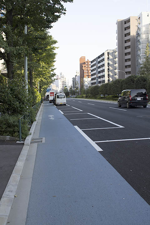
Trucks can block bike lanes – be careful.
This section is all downhill, if you’re on a bike you can actually get a good cruising speed going.
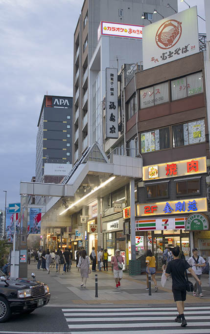
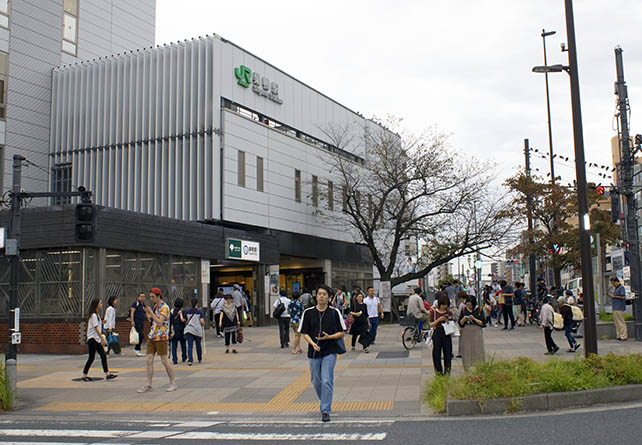
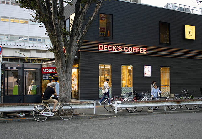
Past this area, you’ll come into Sugamo. There is an APA hotel here, then the Sugamo subway station, with a covered shopping street, a Beck’s Coffee, and other shops and food:
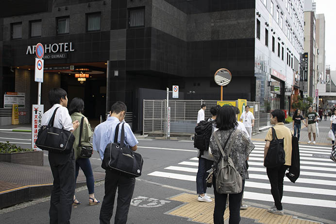
APA Hotel just before Sugamo Station, facing south.
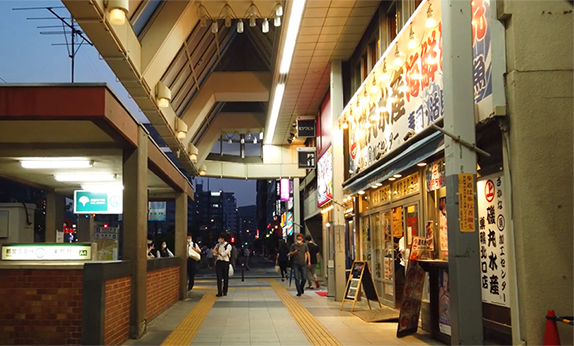
Cruise past the APA hotel, through the covered shopping street, and past Sugamo Station:
Looking back north in the covered shopping area.
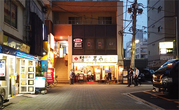
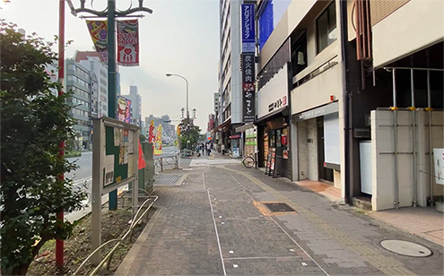
Backstreet, Sugamo.
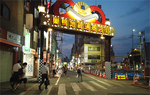
Sugamo Jizo-Dori Shopping Street entrance. On the northwest side of Hakusan Dori. Cross behind the covered street area and enter north here.
Hakusan-Dori looking north back towards Itabashi.
If you want to take a break, there is also an atré shopping area just behind Sugamo Station.
Keep heading south past the station.
After a few more miles, you’ll start to see TDC come into view. The first sign will be the Ferris wheel and roller coaster tracks in the distance:
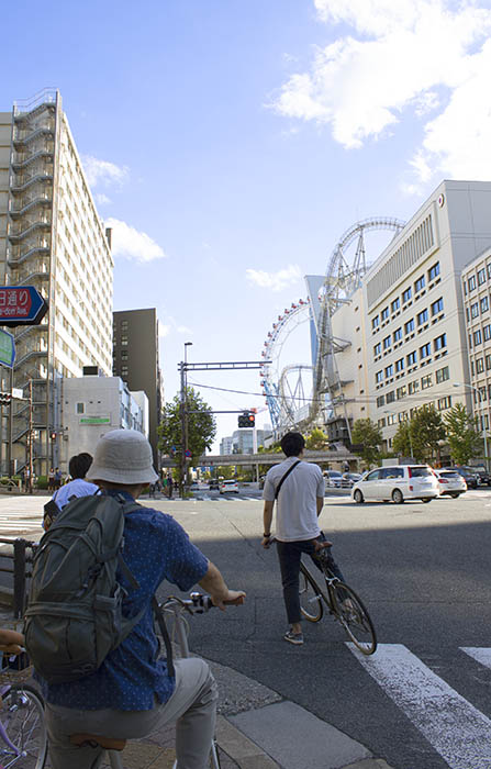
Cruising into Tokyo Dome City, on the right. Biking makes it a quick trip.
If you’re on bike, you’ll want to turn right at the corner shown above because the bike parking lot is 1 block to the right, across from Bunkyo Civic Center. If you’re on foot, you’ll want to continue south for 1 block, then cross at the light and head right into TDC area.
Footnote: if you head left at the intersection shown above, in just a few miles you’ll be in Ueno. If you head left at the next block south shown above, you’ll end up in Akihabara. Both are less than 1 hour’s walk.
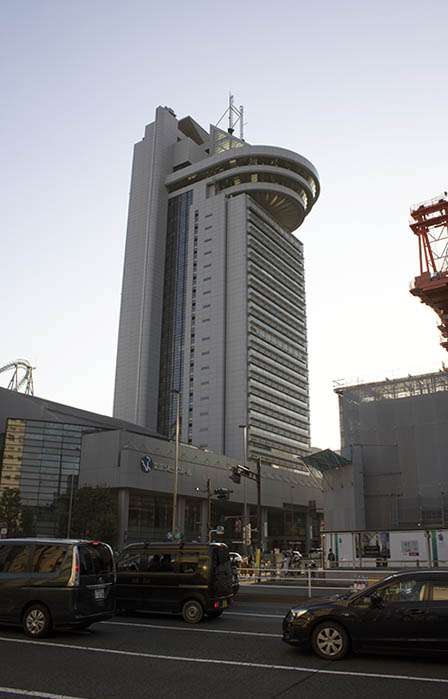
Bunkyo Civic Center. The bike parking lot is just behind it to the right. Also behind BCC is Korakuen Station – one of the most critical stations on the Maronuchi Metro subway line. The round top area of the bldg. is a free observation deck with some of the best views in Tokyo.
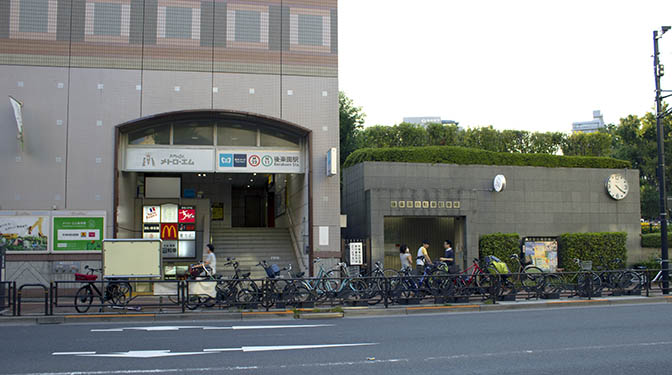
Bike parking, right, Korakuen Station (M22), left. Tokyo Dome City is just to the left. Korakuen Station is the 4th stop on the Maronuchi Line – which makes it an ideal jumping off point to Ikebukuro to the west, and Tokyo Station to the east. You can also get the Namboku Line here, which will shoot you south to Iidabashi Station where you can interchange to the Hanzomon Line for Oshiagé-SKYTREE Station. Hanzomon Line can also shoot you to Shibuya to the south. Ikebukuro is the western terminus.
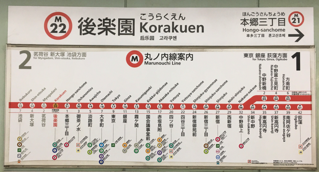
Marunouchi Line map. The current station is shown in red. The small colored circles on the line map indicate interchange stations to other lines. Text is both English and Japanese. Some stations, such as Akasaka-Mitsuke are critical interchanges to major lines such as Ginza and Namboku. The arrows indicate the name + number of the next + previous stations on the line.
There are all kinds of shops along both sides of the streets. Restaurants, and a British “The Hub” pub on the corner at the light. Just to the south of that is Meets Port – another shopping area that is part of TDC.
If you head just up the street to the west behind Tokyo Dome Stadium, you can visit Korakuen Gardens, which is spectacular – it’s less than a block.
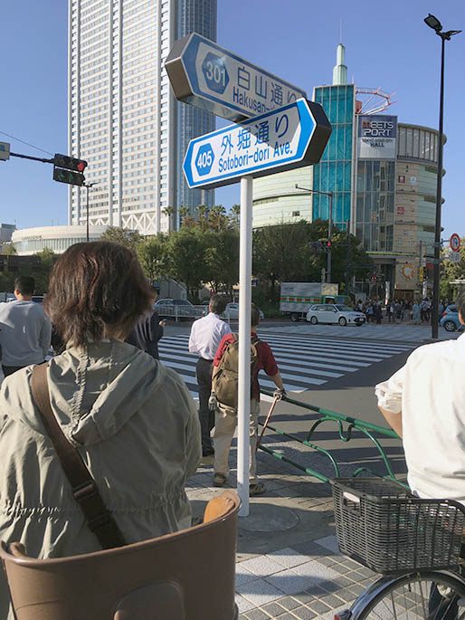
Hakusan-Dori looking back north. Meets Port is just ahead. Turning right on Sotobori-Dori/Rt. 405 will take you back to the east side of Tokyo.
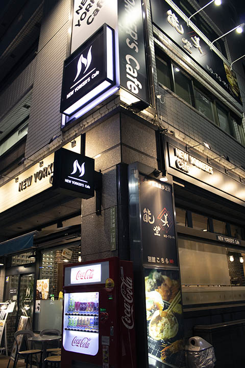
Don’t miss the New Yorker’s Café right across the street.
Well, you made it. Enjoy Tokyo Dome City – there are all kinds of things to do here – rides, restaurants, a grocery store, shopping mall, coffee, and a baseball museum. Nana’s Green Tea matcha parlour is not to be missed in the LaQua mall area. There is also a nice Don Quijote discount store right across the street. There is a luxury hotel as well as a First Cabin capsule hotel right in TDC.
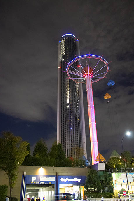
Tokyo Dome Hotel and ride @ Tokyo Dome City.
As a footnote if you head just another block south, you’ll come to Suidobashi Station. See our other article on things to explore around the Suidobashi Station area. That article also covers how to make the trip entirely on bike.
Enjoy your time in Itabashi! We hope this guide makes your visit easier and enjoyable.
LINKS
https://en.wikipedia.org/wiki/Shimo-Itabashi_Station
https://en.wikipedia.org/wiki/Naka-Itabashi_Station
https://www.tokyo-dome.co.jp/meetsport/
Vista House in Tokyo, Japan by Satoshi Kurosaki/APOLLO Architects & Associates
https://tokyocheapo.com/locations/north-tokyo/komagome/
https://tokyocheapo.com/events/autumn-evening-illumination-at-rikugien-gardens/
VIDS
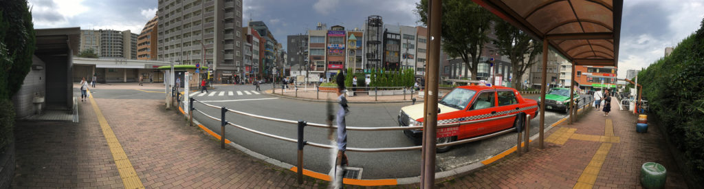
This vid shows both the east and west city sqaures.
Tokyo Drew has a nice vid inside the Tokyo Dome City area